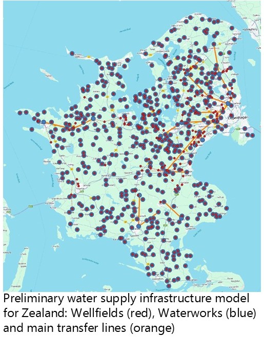
Datasets
Water2050 combines datasets from different sources:
- Wellfields: Points of groundwater abstraction (from GEUS-Jupiter) with annual abstraction permit.
- Waterworks: Points of water supply (from GEUS-Jupiter).
- Water supply areas: Areas connected to the same water waterworks (similar to Schullehner, 2022).
- Demands categorized according to Danmarks Statistik, fysisk vandregnskab. Scaled to water supply areas using population count in the “indbyggertal” dataset.
- Hydrology subdivided in catchments. These are derived by aggregating the 3330 Camels-DK catchments. Groundwater recharge is obtained from the National Hydrologic Model or similar refined local models.
- Regional connections: Transfer lines connecting waterworks.